

The hike went up over lots of slick rock. There were a couple of vertical spots that were pretty scary to me but I was determined not to be left behind and managed to scramble up without falling off.

From the top we had amazing views of the surrounding area.

Then we hiked down and over and up the smaller nearby butte which featured some ancient granaries which were interesting to see.

Our second hike was out Murphy Point which offered excellent views of the three layers that make up the "Island in the Sky" section of Canyonlands. As you look at this photo, imagine that you are at the top layer of the park looking down into the canyon. The white rimmed middle flat area is the "island" between the top and bottom layer. Down below it is the bottom layer where the Colorado River and the Green River flows.

The "White Rim" jeep and bike trail runs along the middle layer. It's a one hundred and three mile loop which takes about three days to bike, assuming you manage to get one of the few permits to camp at the two camp sites along the way.
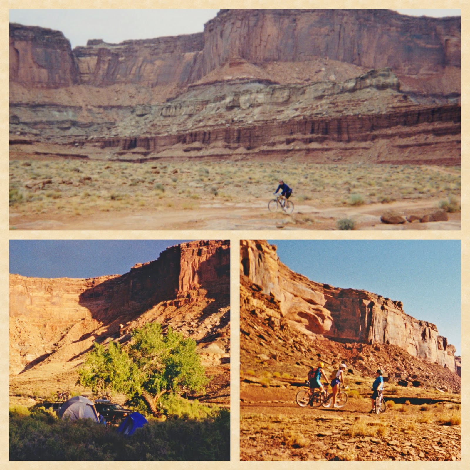
Twenty years ago Ben and I accepted an invitation to join a small group which had a coveted permit and it was an amazing experience to be in this remote and austerely beautiful area. Ben biked most of the way while I mostly drove one of the support jeeps. Traveling the rough and sometimes very steep and rocky road, sleeping under the incredible night sky, and listening to the unusual silence was something that we will always remember. It was fun to look down into the canyon and think about that time.
When I got home I hunted up the photos from that time and scanned some of the best ones.
Can you believe I actually walked out onto Musselman Arch?

I love this photo of Ben.

I borrowed this NPS photo to give you an idea of how far down the middle section is. This is Shafer Trail, which leads down to the White Rim Trail.

It was a long time ago that we did the White Rim trail, but we feel good that we've managed to move out here where it's easier to explore some of the wonders of the west. Who knows what the next twenty years will bring?


Mother Nature at her awesome, glorious best!
ReplyDelete